Iron that works the soil.
Iron that walks where people should never go.
A fleet of nine machines spanning two sectors, built around a single mandate: keep humans alive while the world feeds and powers itself. The units are designed in Stockholm with established manufacturing partners and hardened across pilot production, and each one is named for the job it actually does.
The hand that never tires. The eye that never sleeps.
The world feeds itself on the backs of hundreds of millions of smallholders. Each one stretched between drought, pest, market and time. Our agricultural fleet replaces the tasks no human should still be doing by hand, and leaves the judgment, the land, and the harvest with the farmer who owns them.
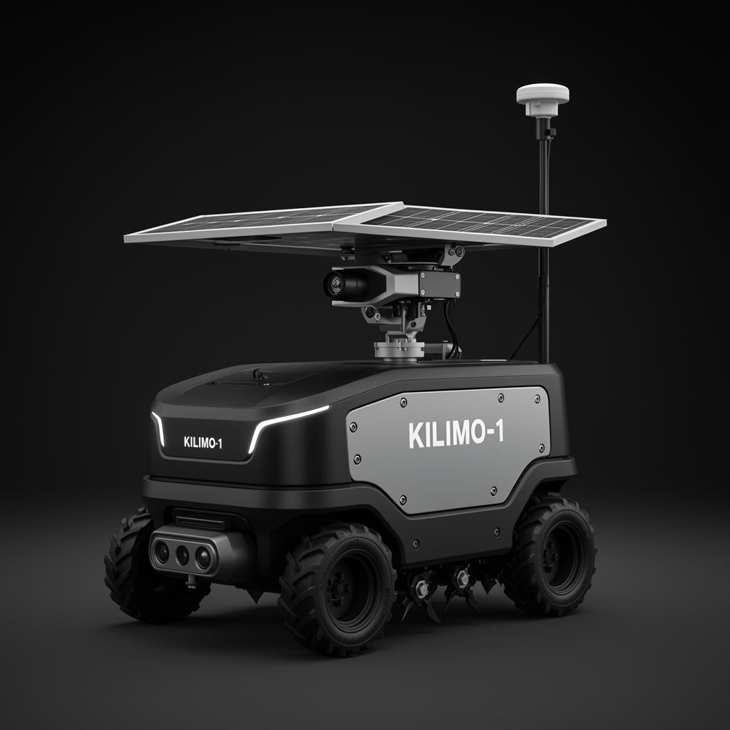
Kilimo-1
A precision-planting, weeding and spraying tractor that runs day and night across small and mid-size plots, cutting water use by 40% and herbicide use by 90%.
A smallholder family spends 18 hours a week weeding by hand. The herbicide alternative poisons their soil. The diesel tractor costs more than the harvest.
- ▸RTK-GPS navigation at ±2cm precision across non-rectangular plot geometries.
- ▸Hot-swappable tool head: planter, mechanical weeder, micro-spot sprayer, soil sensor probe.
- ▸Solar-supplemented 48V powertrain, 14 hours operation, recharges overnight.
- ▸WhatsApp interface, multilingual.
- ▸Vision system identifies crop vs weed, sprays only the weed.
312 cooperatives in pilot production since 2024. Cuts labor by 76%, water by 41%, herbicide by 92%. Repaired with a 13mm spanner and a phone.
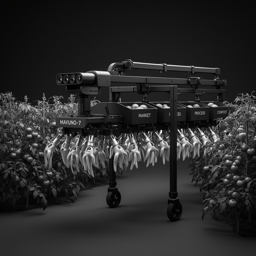
Mavuno-7
A vision-guided harvester that identifies ripeness on the vine and handles tomato, strawberry, avocado and coffee cherry without bruising. 24 tonnes/day at peak.
Up to 40% of a tomato crop is lost between vine and market. Skilled labor is leaving rural areas. Mass-market mechanical harvesters bruise delicate produce.
- ▸Multi-spectral vision identifies ripeness by sugar density, not color alone.
- ▸Soft-pneumatic gripper applies 0.4N per fruit, gentler than a human hand.
- ▸On-board sorting: market-ready, processing, compost.
- ▸Per-fruit data logged for next planting decision.
- ▸Reconfigurable for tomato, strawberry, avocado, coffee, chili.
Pilot cooperative deployments since 2025. Peak 24 tonnes/day. Bruise rate 2.1%. Pays for itself in 14 months.
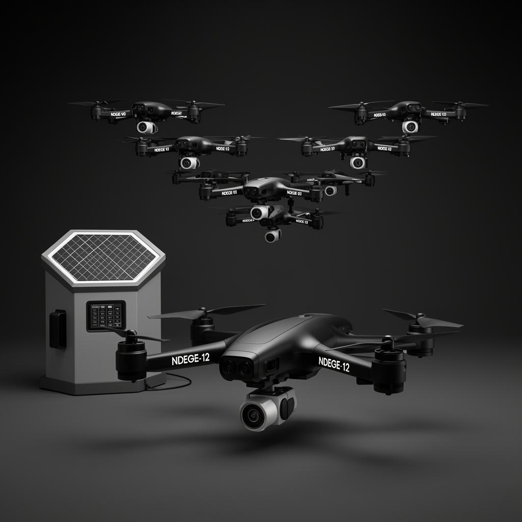
Ndege Swarm-12
A coordinated drone swarm for crop monitoring, pest detection and targeted spraying. Twelve aircraft act as one, cover a 50-hectare farm in 18 minutes.
Fall armyworm strips a maize field in 72 hours. By the time the farmer sees it, the field is lost.
- ▸Twelve drones launch from a single solar-charged ground station.
- ▸Each runs a 40-min sortie, flying assigned grids via mesh networking.
- ▸Hyperspectral imaging detects pest signatures, water stress, nutrient gaps.
- ▸Anomaly-only spray: pesticide only on the 3% of canopy that needs it.
- ▸Returns to base, swaps battery in 8s, redeploys autonomously.
First deployed against fall armyworm in pilot trials, 2025. Pesticide use cut 78%. Outbreaks detected on average 9 days early. Three swarms operating commercially.
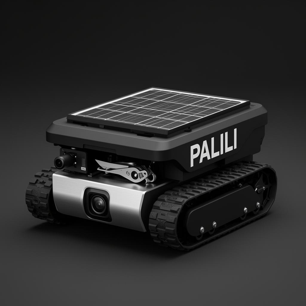
Palili-Micro
A small autonomous weeder that crawls between rows, identifies weeds vs crop, and removes them mechanically. No chemicals, no compaction, no human bent over for 8 hours.
Hand-weeding accounts for up to 25% of all agricultural labor in smallholder farming, most done by women and children. Chemical herbicide poisons soil and water.
- ▸40 kg unit, low-profile, fits row spacing as tight as 22 cm.
- ▸Down-facing vision distinguishes crop seedling from weed seedling in 0.1 s.
- ▸Two cutting modes: micro-laser (zero soil disturbance) or mechanical blade.
- ▸14-hour solar runtime, works through the heat of the day when humans can't.
- ▸Fleets of 6–10 units coordinate across a single field.
Pilots in cassava and bean farms. 96% weed-ID accuracy. 100% herbicide elimination on enrolled plots. Manufactured in China.
Mining is the world's spine. It shouldn't break ours.
The global mining industry posts some of the highest fatality rates of any sector. Cobalt, gold, copper, lithium, extracted in places where the rock has been killing people for generations. We don't make robotics for efficiency. We make them so the next generation of miners can come home from work.
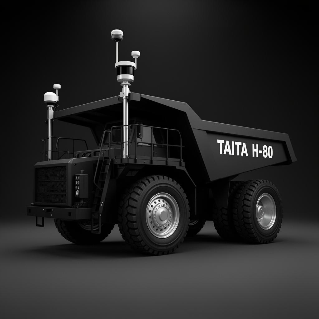
Taita-H80
A driverless 80-tonne haul truck for surface and pit operations. Operates 24/7, eliminates driver fatigue accidents, and reduces fuel burn by 22%.
Haul-truck rollovers and collisions are a leading cause of mine fatalities globally. Driver fatigue at hour 11 of a 12-hour shift kills more miners than rockfalls.
- ▸Centimeter-accurate RTK-GPS + LiDAR + radar fusion.
- ▸Multi-truck coordination, fleets up to 24 trucks share routing.
- ▸Predictive maintenance via 8,000+ on-board sensors.
- ▸Operates in dust, rain, glare, night, without performance loss.
- ▸Remote takeover from a control room hundreds of km away.
Pilot deployments at copper and gold operations. Zero collisions in 380,000 hours. 22% fuel reduction. 17% throughput gain. Drivers re-skilled as fleet supervisors, not displaced.
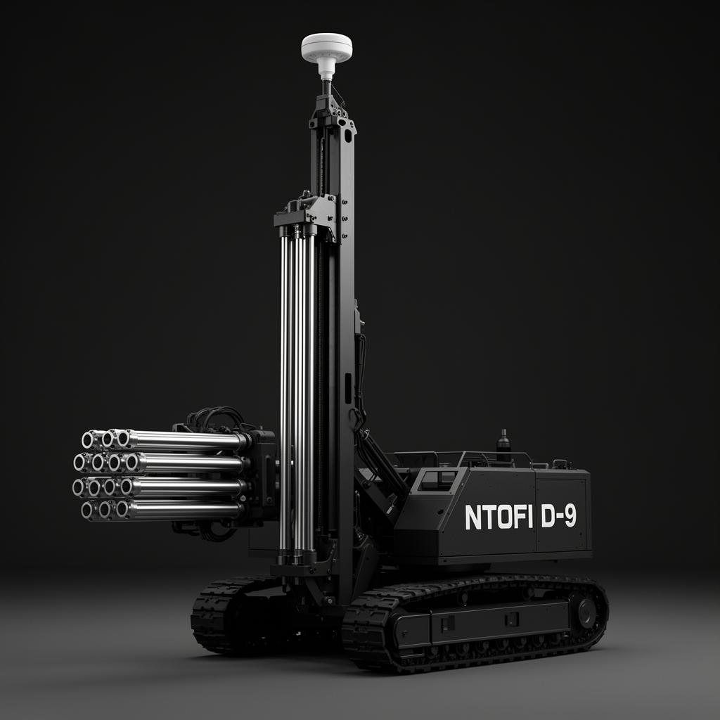
Ntofi-D9
An autonomous drilling rig that places blast holes to ±5 cm of target, reducing wasted energy, oversized rock fragments, and explosive consumption by a third.
Human drill operators work shifts that destroy hearing, lungs and spines. Off-target holes waste explosive, produce oversized rocks, require secondary blasting.
- ▸Survey-grade GNSS positioning to ±2 cm.
- ▸Adaptive drilling based on rock-hardness feedback at the bit.
- ▸Auto-rod handling, no human in blast zone.
- ▸Pattern optimization via reinforcement learning.
- ▸Every hole logged for the next pit.
Tested at chromite and copper pilot operations. 33% reduction in explosive use. 41% fewer secondary blasts. Zero silica exposure.
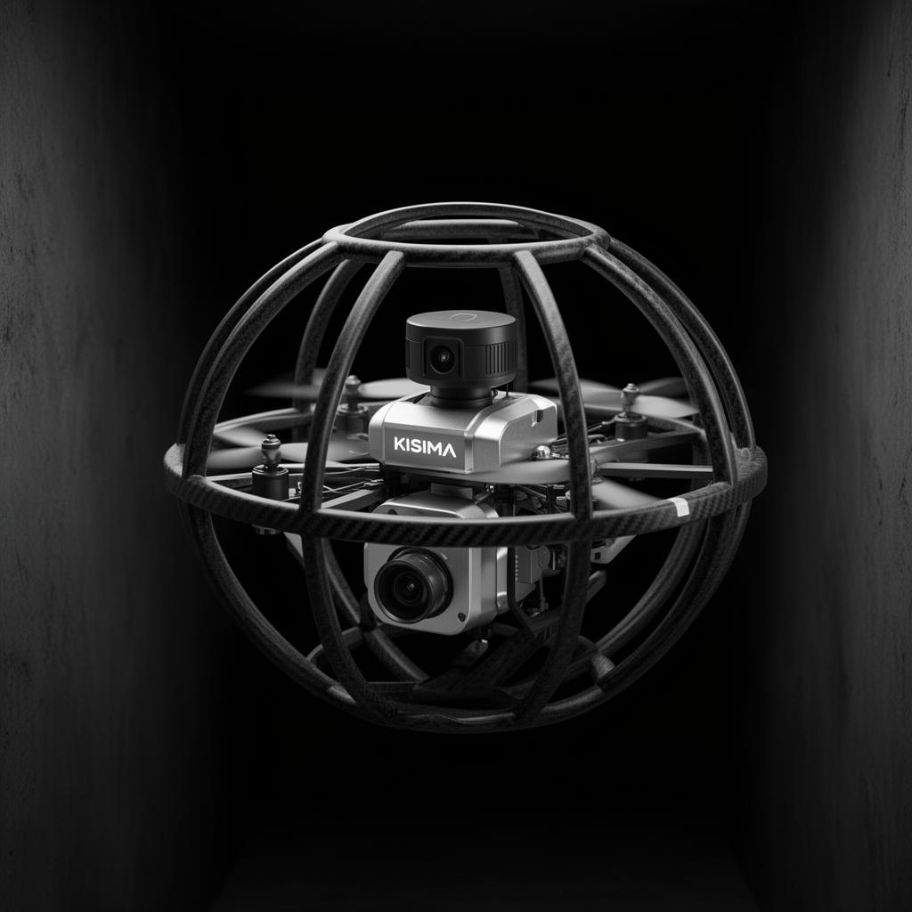
Kisima-Scout
A LiDAR + thermal drone built for confined-space mine inspection, shafts, tailings dams, abandoned workings. Maps in 3D where humans must not enter.
Tailings dams collapse. Old shafts cave in. Every human inspection in these spaces is a coin toss. Brumadinho killed 270 people in minutes, a robot could have flagged it weeks before.
- ▸Caged frame, bounces off walls, recovers, continues mapping.
- ▸Solid-state LiDAR builds mm-accurate 3D meshes in pitch dark.
- ▸Thermal flags water seepage, heat anomalies, electrical faults.
- ▸SLAM-based GPS-denied navigation, finds its way home.
- ▸Generates a weekly digital twin of the space.
Mapped 47 km of underground gold workings and a 4.2-million-m³ tailings facility in pilot programs. Detected three previously unknown voids. Two interventions credited with averting collapse.
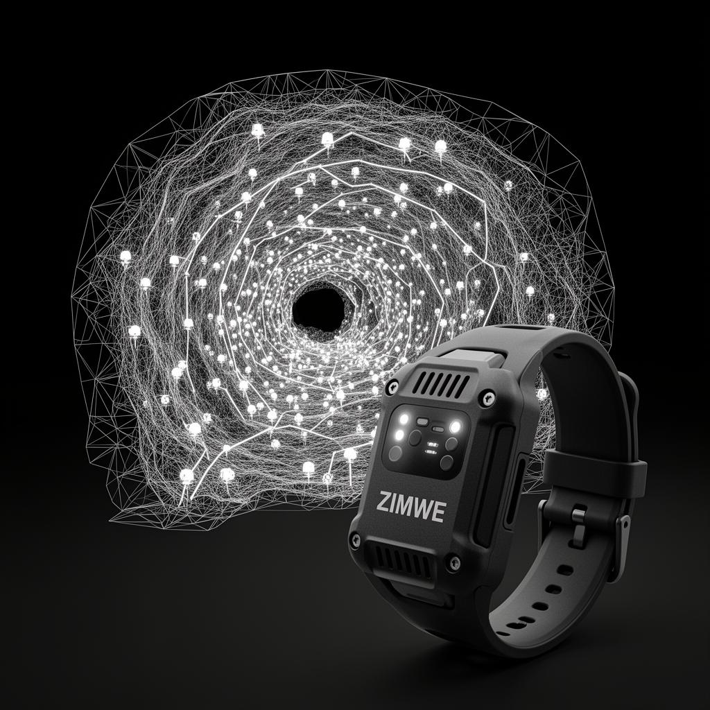
Zimwe-Predict
A wearable-sensor and digital-twin system that builds a live virtual model of the mine, predicting structural, atmospheric and equipment failures before they kill.
Mines fail in patterns visible only in aggregate. A single roof-bolt strain reading means nothing. Ten thousand bolts, atmospheric data, equipment vibration, biometrics, that's a model that can see disaster forming. Most mines have all the data and none of the model.
- ▸Every miner wears a sensor band, air, heart rate, location, stress.
- ▸Fixed structural sensors stream strain, vibration, temperature continuously.
- ▸All feeds fuse into a live 3D digital twin updated every 4 seconds.
- ▸A neural model predicts incident probability per zone.
- ▸Auto-evacuation triggers above threshold; auto-rerouting below.
Pilot at platinum and gold operations. Predicted two roof-fall events with 6+ hour warning. Caught one CO leak before alarms. Expanding to additional copper sites.
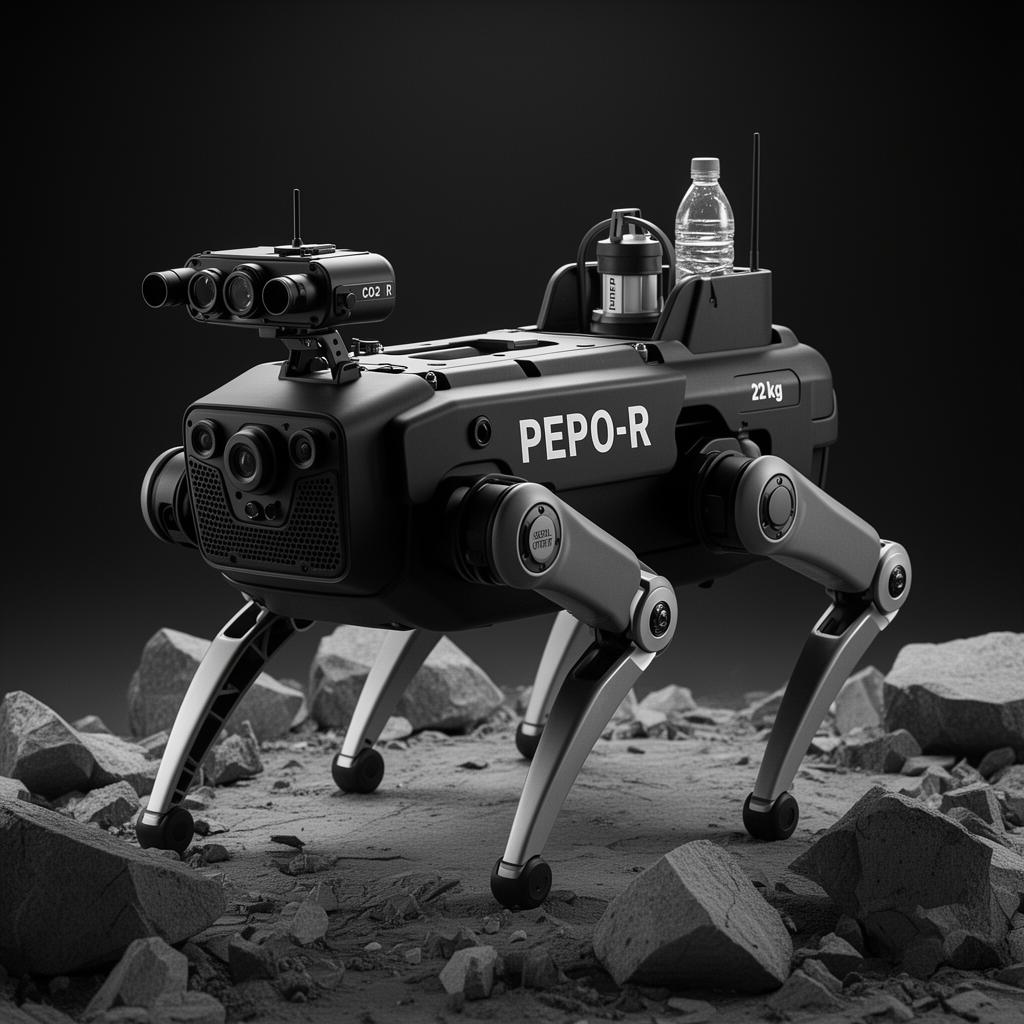
Pepo-R
A quadrupedal rescue robot for post-disaster missions in collapsed shafts, flooded workings and GPS-denied underground environments. Designed to find survivors when no human can go.
After a mine collapse, every hour costs lives. Human rescue teams enter unstable terrain through gas, water and aftershock. Many die alongside the miners they're trying to save.
- ▸Four-legged platform, traverses rubble wheels and tracks cannot.
- ▸Acoustic localization detects faint human sounds through debris.
- ▸Thermal + CO₂ sensors find breathing humans behind 2 m of rock.
- ▸Two-way audio module, survivors hear a voice.
- ▸Drops resupply packets: water, light, oxygen, satellite beacon.
- ▸Builds map for the human rescue team that follows.
Trial deployments with mine rescue services since 2025. Two simulated rescues completed. First field emergency expected late 2026. Built to be the machine you hope you never need.
Nine machines. One operating system.
Every unit on this page runs on the same neural backbone, ships with the same multilingual operator interface, and reports into the same digital-twin layer. This is what makes the fleet greater than the sum of its parts.
- ▸WhatsApp & SMS control, multilingual
- ▸Printed manuals every unit ships with, no cloud required
- ▸Voice prompts in operator's first language
- ▸Vision: crop/weed, ripeness, fault, structural strain
- ▸Spatiotemporal GNN for digital-twin prediction
- ▸RL drilling & swarm coordination
- ▸SLAM in GPS-denied underground environments
- ▸On-device inference, works without connectivity
- ▸Mesh + LoRa + 4G/5G hybrid radio
- ▸Predictive-maintenance telemetry on every powertrain
- ▸312 cooperatives in pilot production
- ▸Three operator-mine partnerships in active trials
- ▸Mine rescue services · field trials
- ▸Foundations: bridge financing for cooperative units
Want one of these in your operation?
Government, cooperative, mine operator, foundation, family farm, the conversation starts the same way. Tell us what's breaking. We'll tell you which unit you actually need, or whether you need one at all.
Start a conversation →